


Oranto Petroleum Limited (OPL) has successfully completed a Two Dimensional (2D) seismic data acquisition survey over the Ngassa block in the Albertine Graben. OPL contracted IMC Geophysical Services Limited from the United Kingdom to undertake the survey, which commenced on April 15, 2019, and was completed on May 18, 2019.
“The survey involved the acquisition of 326 line kilometres of off shore (on Lake Albert) 2D seismic data over the Ngassa Contract Areas. The conclusion of this exercise represents an important step by the licensee in fulfilling its obligations for the first two-year exploration phase that runs from October 2017 to October 2019,” said Mr. Dozith Abeinomugisha, Director Exploration at the Petroleum Authority of Uganda (PAU).

The two stratigraphic licenses of Ngassa Deep Play and Ngassa Shallow Play Contract Areas were awarded to Oranto Petroleum Limited from Nigeria in October 2017 by the Minister of Energy and Mineral Development, for a period of four (4) years. This is the first time Uganda undertook stratigraphic licensing, where two licenses are issued vertically over the same block. This is to ensure that all potential oil and gas zones in the area are fully evaluated through implementation of the work programmes aproved by the Petroleum Authority of Uganda.
The Ngassa block lies on the eastern banks of Lake Albert, within the villages of Tonya A, Tonya B, Kijjangi, Mbegu, Kaiso and Kyehoro, in Hoima and Kikuube districts. The Ngassa block, which was initially part of Exploration Area 2 licensed to Tullow Uganda Operations Pty Limited, reverted to Government after the expiry of Tullow’s appraisal period. The block is covered by good quality 2D seismic data acquired between 2003 and 2008. A third of the block is covered by 3D seismic data.
Since the Ngassa prospect lies entirely under the lake, two deviated wells, Ngassa-1 and Ngassa-2 were drilled on land at the periphery of the main structure between 2007 and 2009, respectively, in order to access the reservoirs. Oil and gas shows were encountered by the two (2) wells; however, a large part of the prospect was untested. This implies that additional exploration work was required to fully assess the potential of the prospect.

“Oranto Petroleum Limited will now process and interpret the acquired data. The results will inform the subsequent activities during the next two year phase of the exploration period. We expect Oranto Petroleum Limited to revert to the PAU by October, 2019, with a detailed work programme for drilling at least one exploration well on Lake Albert within the next two years,” said Mr. Abeinomugisha.
The acquired data will be analysed together with the pre-existing 2D and 3D data to better define the North Eastern part of the Ngassa mega prospect. OPL has also undertaken other technical studies as part of the exploration work programme, including reprocessing of the existing seismic data, Amplitude versus Offset (AVO) and petrophysical studies over the Ngassa 1 and 2 wells to evaluate the quality of the reservoir horizons penetrated by these wells as well as studies related to a drilling solution on Lake Albert.
Mr. Abdul Byakagaba Bazara, the General Manager, OPL, described the exercise as a big success.
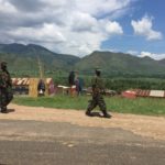
“We have received great support from Government, the local leaders and communities in the area where we are operating. The UPDF and Uganda Police have provided us with security throughout this exercise, which has been undertaken without incident,” he said.
A Joint Security Team that comprised the Uganda People’s Defence Forces (UPDF), Uganda Police Force (UPF) and the Internal Security Organisation (ISO) led by Brig. Michael Nyarwa, the Commandant of the UPDF Marine Unit, oversaw the security for the exercise.
“We secured the operations on land, water and air, and our team also worked closely with the local community for intelligence gathering,” said Brig. Nyarwa.
Mr. Ali Tinkamanyire, the LC3 Chairperson for Buseruka Subcounty in Hoima district said he was happy that the data acquisition survey provided employment opportunities.
“I thank Oranto Petroleum Limited for using labour from the local communities during this exercise and I hope, in the future, even more people benefit from the opportunities created by oil and gas activities,” he said. Mr. Tinkamanyire also called on the Government to ensure local content through OPL’s use of locally available food and other items, and skilling of the local manpower.
The PAU is mandated to monitor and regulate petroleum activities in the country; this includes approving the licensees’ work programmes and ensuring that these are undertaken in an efficient manner. The PAU’s regulatory role also includes monitoring of national content development in the oil and gas sector.
“Over 70% of the workforce employed during the survey were Ugandans. In addition, OPL has subcontracted Uganda firms to provide legal services, security services, camping, catering and general maintenance services”, Mr. Byakagaba added.
Prior to this exercise, thirty-two (32) seismic surveys had been undertaken in the Albertine Graben, resulting in the acquisition of approximately 7,000-line kilometres of 2D seismic data and approximately 2,000 square kilometres of 3D seismic data. 2D seismic data displays a slice of the earth while 3D seismic data displays a three dimensional model of the subsurface.
What is a seismic survey?
A seismic survey is a method, typically used during the exploration and appraisal phase of oil and gas operations. This method gives a clearer idea of the structures underneath the earth’s surface (subsurface). The method involves the use of energy produced by instruments such as a seismic vibrator (on land/ onshore) or an airgun (in water/ offshore) to generate waves that go through the earth’s layers and “bounce-back” from different rock layers. The reflected and refracted waves are recorded by receivers (geophones on land or hydrophones in water) to produce the first image of the subsurface.
This technique allows for interpretation of what may lie underneath the ground or seabed (oil, gas, water, faults, folds etc) without having to drill into the earth. The acquired data is used by companies to make decisions of a suitable location where to drill a well.
The onshore seismic operations usually use specialised trucks that carry a heavy plate that is vibrated to generate a seismic signal.
During a marine survey, the seismic vessel travels about five knots in a predetermined pattern and tows one or two sound sources to generate sound waves, and one or several long cables or “streamers,” containing hundreds of evenly-spaced hydrophones. The position of the vessel and equipment must be carefully controlled, using advanced navigation and acoustic systems, to ensure geological features are pinpointed accurately.
Each streamer can be up to 12km long and is towed 6 to 15m below the water surface to reduce the effect of ocean waves on the acquired data. In the most technically advanced seismic surveys, up to 12 streamers are towed at the same time, each about 50 to 150m apart. The seismic acoustic source array emits a sound following a particular configuration repeatedly as the seismic vessel moves along a straight ‘data acquisition’ line at a specific speed.
Seismic operations begin with a “soft-start”. This is the gradual increase of the sound level of the source on either onshore or offshore during the survey. The reason for this approach is to enable animals that are within the vicinity to move away to areas that are not affected by the noise of the source.
The difference between 2D and 3D seismic data acquisition is in the process of acquiring the data. For 2D seismic data acquisition, the source and receivers are placed on one-line direction, and what is therefore acquired is a slice of the earth seen from a side view showing the information directly under the receiver and source line.
For 3D seismic data acquisition, a number of sources and receivers are laid out in a grid form on the surface, intersecting each other, and achieving multiple data points. This enables achieving a three dimensional (3D) model of the subsurface.


Comments are closed.